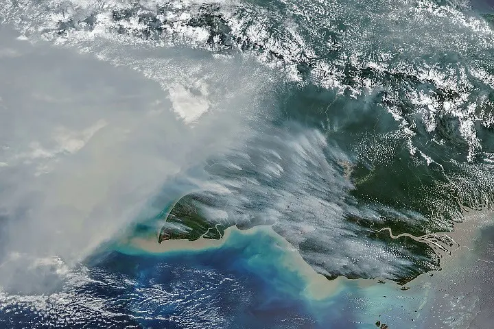
A NASA Earth Observatory feature published on October 22, 2026, documents fires and smoke across New Guinea during a period of unusually dry conditions. The accompanying NOAA-20 VIIRS image was captured on October 11. The report combines imagery with fire-emissions information to examine conditions on both the Indonesian and Papua New Guinean sides of the island.
What the satellite record contributes
The feature describes high fire activity and smoke spreading across the southern part of New Guinea. It discusses drought and the way human-set fires can spread under dry conditions. These are observations and analysis tied to the report’s October reference period, rather than an assertion that the same conditions persist unchanged today.
A satellite image provides a broad view that can be difficult to assemble from individual local accounts. It does not independently establish every impact at ground level. The feature’s use of several kinds of information is important: imagery, emissions estimates and local reporting answer related but different questions.
The business question is how evidence becomes an action
Our interpretation is that organizations exposed to environmental disruption need an explicit path from observation to review. A supplier network, transport plan or workplace may be affected in different ways, and a regional image alone does not reveal which operation needs to change. The relevant manager needs to understand the location, timing and dependency involved.
A hypothetical logistics team could use a dated satellite observation as a reason to check local operational information. It would still need current confirmation before changing a route or communicating a service interruption. Keeping the source, time and uncertainty attached to the observation makes that handoff more useful.
The broader lesson is to connect remote-sensing products with accountable decisions. Better visibility can improve awareness, but it does not eliminate the need for local context. Current conditions and any protective actions should be assessed through up-to-date official information rather than inferred from an archived image.